Google Maps is an incredibly powerful tool, and every day we see more and more evidence of the cool things people are doing with the platform. Some of the newest features, like the Wikipedia, Video and Bicycle views are impressive enough, but it’s only when you see what other organizations around the world are doing with the map data, that you appreciate just how valuable digital cartography is today.
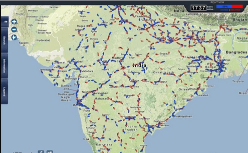
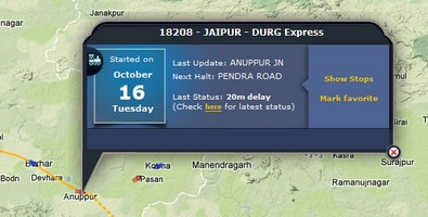
The Rail Radar application, for example, features a live overview of the whole Indian railway system, which means a snapshot of up to 3000+ trains running across the Indian subcontinent, with detailed information on the route, delays, and scheduled stops. To say it’s impressive is an understatement.
Looking at this application, it’s not hard to imagine a time when the mass transit of the whole world will be available for instant viewing, which could seriously change the way we travel and plan our travel in general. The car may be heading for a decline, or at least a significant shift in our priorities as oil becomes more expensive, but mass transit should enjoy a new lease of life with these new online tools.
What’s really interesting is the fact that the app is coming from somewhere which is not really thought of as a highly connected high tech country, and yet it puts ‘big shot’ places like Europe to shame. Sign of the times?


