So things didn’t go quite as planned for the mighty Apple corporation with their recent release of maps for iOS. Apparently it’s not so easy to do mapping properly, who would have guessed? The black eye has been compounded by the fact that Google seems to be running away with the whole mapping functionality stuff, just take a look at their latest offerings like bicycle routes, labels and webcams. That’s just rubbing it in.
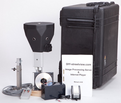
But we’ve got a secret weapon for Apple Corp (it’s OK guys you can thank us later) in the shape of the DIY StreetView Kit. The kit comprises a full 360 degree camera, an image processing server and full support and software to make the whole thing work. The system includes self-leveling technology and full orientation and geo-tagging GPS sensors and comes supplied in a watertight, crushproof transport case.
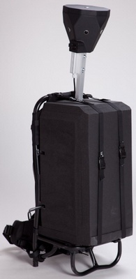
What’s more there’s a range of adapters for mounting on a car, or even a backpack (above) which you can use for those tight spots where a vehicle can’t enter. Basically with this kit, the big Apple could be out and about capturing the world in a matter of weeks, rather than years.
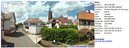
Of course it’s not only Apple that could make use of this sort of equipment. Any location where the Google team can’t or won’t reach, can now offer their own sophisticated map service with street level views, which is great news for tiny villages, inaccessible locations and large difficult to map areas like conservation parks or wildlife sanctuaries.
The baseline version of the kit is priced at $14,500 (the backpack accessory is an extra $1450) ready to go, all you need to supply is the manpower and a lot of online storage space – may we recommend Amazon S3? – to hold your data. Good luck, we’ll be rooting for you.


