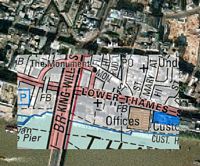
Wow, Multimap appears to be playing around with some new technology to overlay detailed street maps on top of aerial photos. Super cool application, although I’m not sure how much use it is in dense urban areas. Not sure how to access it generally either.