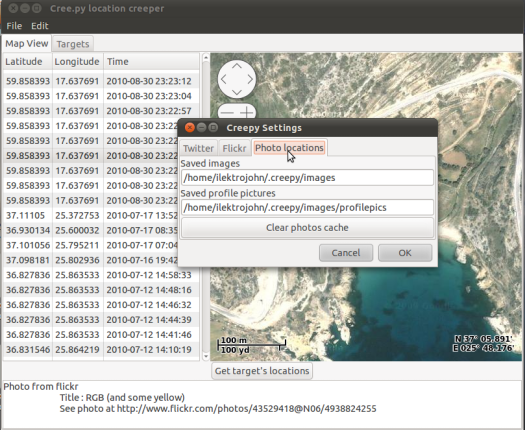
The internet has given us countless ways to stealthily check up on people who we are interested in. Facebook is an obvious choice for the task, but what about Flickr, or Twitter? Sure, they can provide you with a little bit of info each. However, with a piece of software, you can use those services to track exactly where someone has been. Creepy? Yes.
No, really, that’s the name of the program. Creepy. The software takes geocoded data from Flickr images and Twitter tweets and maps them out on a handy map. Sure, there are cool uses for this, such as mapping out a road trip that you took, simply by following the trail of tweets. However, as the name implies, it will no doubt be used for shadier purposes as well.


